
• +91 8074692090
  • slokainfrasolution@gmail.com

Sub-Bottom Profiler Survey

Sub-Bottom Profiler Survey

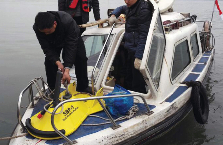
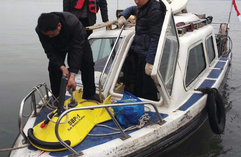
Sub-bottom profiler surveys are essential for revealing the layers beneath the seabed, providing critical information about subsurface geology. Sloka Infra Solutions employs advanced sub-bottom profiling technology to map sediment layers, identify geological features, and detect buried objects. This service is particularly important for offshore drilling, cable and pipeline installation, and archaeological studies. Our sub-bottom profiler surveys offer a detailed understanding of the subsurface environment, helping to assess potential risks and guide project planning. We deliver clear, high-resolution images of sub-surface layers, enabling you to make informed decisions based on accurate geological data. Whether for resource exploration or construction, our sub-bottom profiler surveys provide the insights you need to succeed.

Sub Bottom Profiler Survey

Advanced Sub Bottom Profiler (SBP) surveys for mapping geological layers beneath the riverbed and seabed, providing critical subsurface information for engineering, construction, and geotechnical investigations.

01

Pipeline Engineering

Identify subsurface conditions to support safe pipeline routing, installation, and maintenance.

02

Sediment Thickness

Measure sediment layer thickness accurately for dredging, reservoir, and environmental studies.

03

Geological Investigation

Map subsurface geological formations to assist geotechnical analysis and foundation design.

04

Offshore Construction

Provide detailed subsurface data for offshore structures, marine infrastructure, and coastal development.

Sub-Bottom Profiler Survey

Sub-bottom profiler surveys are essential for revealing the layers beneath the seabed, providing critical information about subsurface geology. Sloka Infra Solutions employs advanced sub-bottom profiling technology to map sediment layers, identify geological features, and detect buried objects. This service is particularly important for offshore drilling, cable and pipeline installation, and archaeological studies. Our sub-bottom profiler surveys offer a detailed understanding of the subsurface environment, helping to assess potential risks and guide project planning. We deliver clear, high-resolution images of sub-surface layers, enabling you to make informed decisions based on accurate geological data. Whether for resource exploration or construction, our sub-bottom profiler surveys provide the insights you need to succeed.